

Where to buy
Learn more >

Core technology highlights


Both hardware and software products are available
")
Provides real-time monitoring, tracking and reporting capabilities to ensure drone safety and compliance.
Combining drone technology with cloud computing, a system for remote control, data storage and analysis of monitoring tasks is implemented.
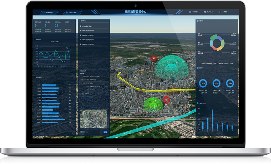

Support remote management
Data security
Support full link data reception
Support multiple data reporting protocols
Organizations, agencies and departments that need to monitor airspace
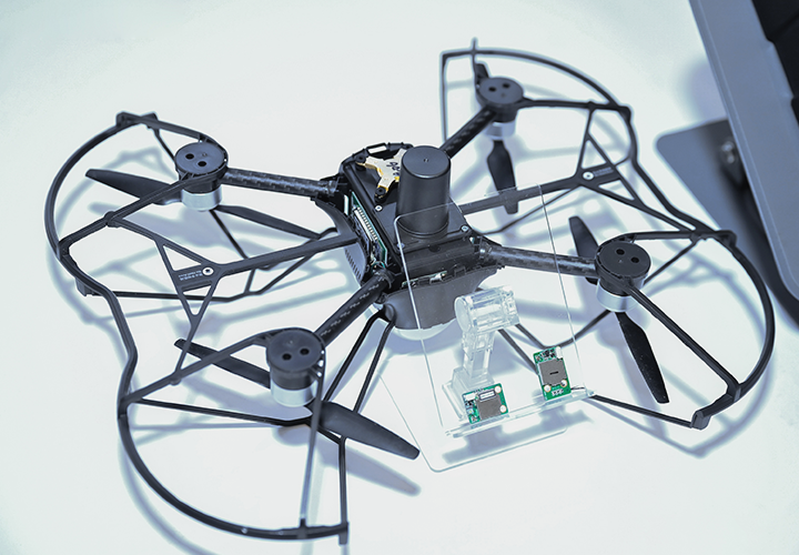
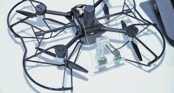
RID-BC-002C integrates batteries, multi-mode GNSS modules, barometric altimeters, antennas and other devices, and has the ability to work independently.
Micro/light/small drones
")
")
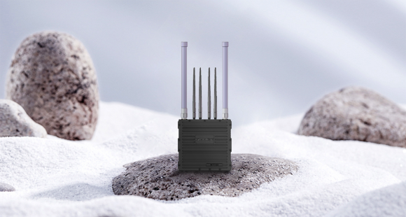
RID-BC-002B integrates multi-mode GNSS modules and barometric altimeters at the hardware level, and can work independently without interacting with additional sensors.
Stock drones
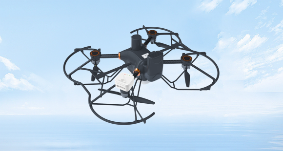
Multiple broadcasting methods
Broadcast channel adjustable
Support OTA upgrade and configuration
Automatic/programmed working mode
Rich interface protocols
Micro/light/small drone
Application Scenario


Core technology highlights
Both hardware and software products are available
Support remote management
Data security
Support full link data reception
Support multiple data reporting protocols
Organizations, agencies and departments that need to monitor airspace
RID-BC-002C integrates batteries, multi-mode GNSS modules, barometric altimeters, antennas and other devices, and has the ability to work independently. Unmanned aerial vehicles can be equipped with this product through bundling/brackets/sticking, etc., so that it has the ability of remote identification and meets the low-altitude unmanned aerial vehicle operation requirements in various regions.
Micro/light/small drones
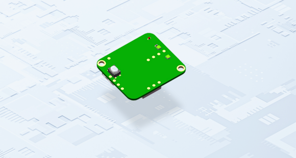
RID-BC-002B integrates multi-mode GNSS modules and barometric altimeters at the hardware level, and can work independently without interacting with additional sensors. It has the advantages of small size, light weight, low power consumption and built-in shielding cover. The 2.4GHz antenna interface and multi-mode GNSS antenna interface provided are convenient for integration by manufacturers of operation identification products and drone manufacturers.
Stock drones
Multiple broadcasting methods
Broadcast channel adjustable
Support OTA upgrade and configuration
Full coverage of parameter configuration capabilities
Automatic/programmed working mode
Rich interface protocols
Micro/light/small drones
Application Scenario


Mailbox number:marketing@hg-fly.com